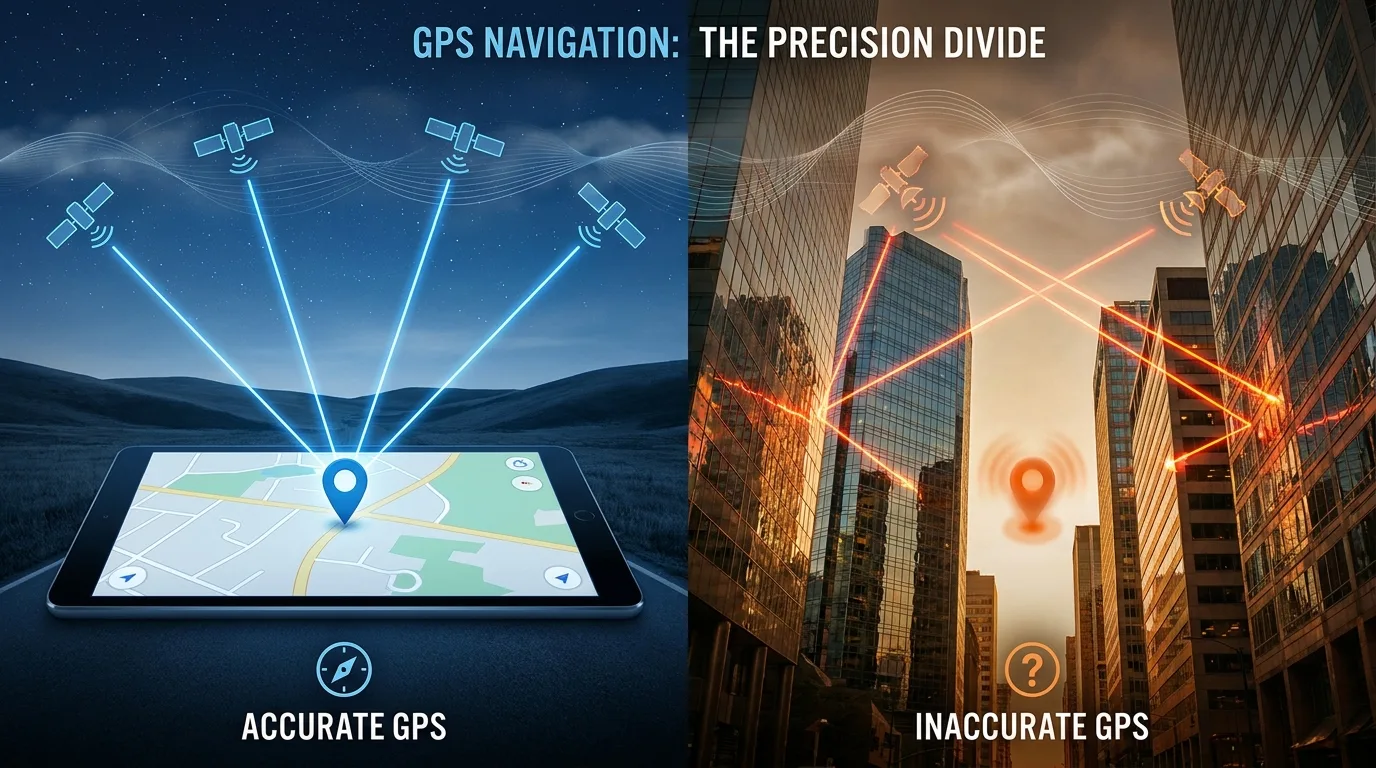
We have all experienced the profound frustration of a navigation system that seems determined to lead us astray. You are driving through an unfamiliar city, the rain is pouring down, and your smartphone confidently instructs you to turn left onto a road that clearly does not exist. Or perhaps you are hiking in a dense forest, watching your location dot bounce erratically across the screen like a confused firefly, placing you hundreds of meters away from your actual position. In these moments, it is easy to blame the technology entirely or assume that the satellite network has simply failed. However, the reality of Global Positioning System inaccuracies is far more complex and fascinating than a simple technical malfunction. GPS is a marvel of modern engineering, yet it operates within a delicate ecosystem of physics, geography, and atmospheric conditions that can conspire to produce errors. Understanding why GPS is sometimes wrong requires us to look beyond the device in our hands and examine the invisible journey of signals traveling from space to Earth.
⚛️ The Physics of Precision and Atomic Clocks
To understand error, one must first understand how GPS achieves its remarkable accuracy under ideal conditions. The system relies on a constellation of satellites orbiting approximately 20,000 kilometers above the Earth. Each satellite carries multiple atomic clocks that are synchronized to within nanoseconds. Your receiver determines its position by measuring the time it takes for signals to travel from at least four satellites to your device. Since radio waves travel at the speed of light, even a timing error of one microsecond can result in a positional error of 300 meters. This extreme sensitivity to time is both the system’s greatest strength and its most significant vulnerability.
The satellites themselves are subject to the effects of Einstein’s theories of relativity, which introduce natural discrepancies that engineers must constantly correct. According to Special Relativity, because the satellites are moving at high speeds relative to observers on the ground, their onboard clocks tick slower by about seven microseconds per day. Conversely, General Relativity dictates that because the satellites are in a weaker gravitational field than we are on Earth’s surface, their clocks tick faster by about forty-five microseconds per day. The net effect is that satellite clocks run fast by approximately thirty-eight microseconds daily compared to ground-based clocks. If left uncorrected, this relativistic drift would cause GPS positioning errors to accumulate at a rate of roughly ten kilometers per day, rendering the system useless within hours. Engineers build these corrections directly into the system’s hardware and software, but any residual miscalibration or unexpected variation in clock performance can still introduce subtle inaccuracies that compound over time.
🌍 Atmospheric Interference and Signal Delay
Even if the satellites were perfect timekeepers, the signals they transmit must traverse a turbulent and variable atmosphere before reaching your receiver. The ionosphere and troposphere act as refractive media that slow down and bend radio waves, introducing delays that translate directly into distance errors. The ionosphere, a layer of charged particles extending from about sixty to one thousand kilometers above the Earth’s surface, is particularly problematic. Solar activity, geomagnetic storms, and even the time of day can dramatically alter the density of free electrons in this layer, changing how much the signal is delayed. During periods of intense solar flares, ionospheric disturbances can cause GPS errors to spike significantly, sometimes making precision navigation impossible for hours or even days.
The troposphere, the lowest layer of the atmosphere where weather occurs, introduces additional delays caused by water vapor, temperature variations, and pressure changes. Unlike the ionosphere, which affects signals differently depending on frequency, tropospheric delay is non-dispersive and cannot be eliminated by comparing dual-frequency signals. Instead, receivers must rely on mathematical models and real-time meteorological data to estimate and compensate for this delay. These models are generally effective but imperfect, especially during rapidly changing weather conditions or in regions with complex microclimates. A sudden thunderstorm or an unexpected temperature inversion can create localized atmospheric anomalies that the standard correction algorithms fail to predict, resulting in position errors that may persist until conditions stabilize.
🏙️ Urban Canyons and the Multipath Nightmare
For most everyday users, the single largest source of GPS error is not atmospheric interference or clock drift but the built environment itself. In urban areas, tall buildings, bridges, and other structures create what navigational scientists call “urban canyons.” In these environments, the direct line-of-sight signal from a satellite may be completely blocked, forcing your receiver to rely on reflected signals that have bounced off glass facades, concrete walls, or metal surfaces. This phenomenon, known as multipath interference, causes the receiver to calculate a longer signal travel time than actually occurred, placing your estimated position somewhere between your true location and the reflecting surface.
Multipath errors are notoriously difficult to correct because the geometry of reflections changes constantly as you move and as satellites traverse the sky. Modern receivers employ sophisticated signal processing techniques to identify and reject reflected signals, but these algorithms are not infallible. In dense downtown cores with narrow streets flanked by skyscrapers, the number of viable direct signals may drop below the four needed for three-dimensional positioning, forcing the receiver into a degraded two-dimensional mode or causing it to incorporate weak, unreliable signals into its calculations. The result is the familiar experience of watching your blue dot jump across city blocks, spin in circles at intersections, or stubbornly insist you are inside a building when you are clearly standing on the sidewalk. Even pedestrian-level navigation apps struggle in these environments, and autonomous vehicles require extensive supplementary sensor systems precisely because GPS alone cannot provide reliable positioning in urban canyons.
💰 Economic Realities and Infrastructure Investment
Addressing GPS inaccuracies is not merely a technical challenge but also an economic one. Governments and private companies invest enormous sums in improving positioning infrastructure, and these investments directly affect the quality of service available to end users. For example, national augmentation systems like the United States’ Wide Area Augmentation System or Europe’s European Geostationary Navigation Overlay Service broadcast correction signals that can reduce GPS errors from several meters to less than one meter. The development and maintenance of such systems cost hundreds of millions of dollars annually. When budget constraints limit upgrades or delay the deployment of new ground reference stations, users in affected regions experience measurably worse positioning performance.
Consumer devices also reflect economic trade-offs. A high-end surveying receiver costing approximately $13,600, illustrating how geographic and economic factors influence access to precise navigation technology worldwide.
🔮 The Future of Resilient Positioning
Recognizing the inherent limitations of satellite-based navigation, researchers and engineers are developing complementary technologies designed to fill the gaps where GPS falters. Visual positioning systems use camera imagery and machine learning to match surroundings against massive georeferenced databases, providing accurate localization even indoors or underground where satellite signals cannot penetrate. Inertial measurement units combining accelerometers, gyroscopes, and magnetometers can maintain short-term positional awareness during brief signal outages. Cellular network positioning, Wi-Fi fingerprinting, and Bluetooth beacon systems offer additional layers of redundancy in urban and indoor environments.
The next generation of satellite constellations is also being designed with resilience in mind. Newer satellites broadcast signals on multiple frequencies, enabling receivers to better characterize and correct for ionospheric delays. Improved atomic clock technologies promise greater stability and reduced drift. Ground-based pseudolites and low-Earth-orbit satellite augmentations aim to strengthen signal availability in challenging environments. However, no single technology will ever completely eliminate positioning uncertainty. The future lies not in achieving perfect GPS accuracy everywhere but in building intelligent systems that seamlessly fuse multiple data sources, recognize when individual inputs are unreliable, and gracefully degrade rather than catastrophically fail. Users should cultivate realistic expectations, understanding that GPS is an extraordinarily powerful tool that nevertheless operates within the bounds of physical law and practical engineering constraints. The next time your navigation app leads you slightly astray, remember that you are witnessing the intersection of relativity, atmospheric science, urban geometry, and economic reality, all compressed into a tiny chip working tirelessly to tell you where you are in an impossibly complex world.