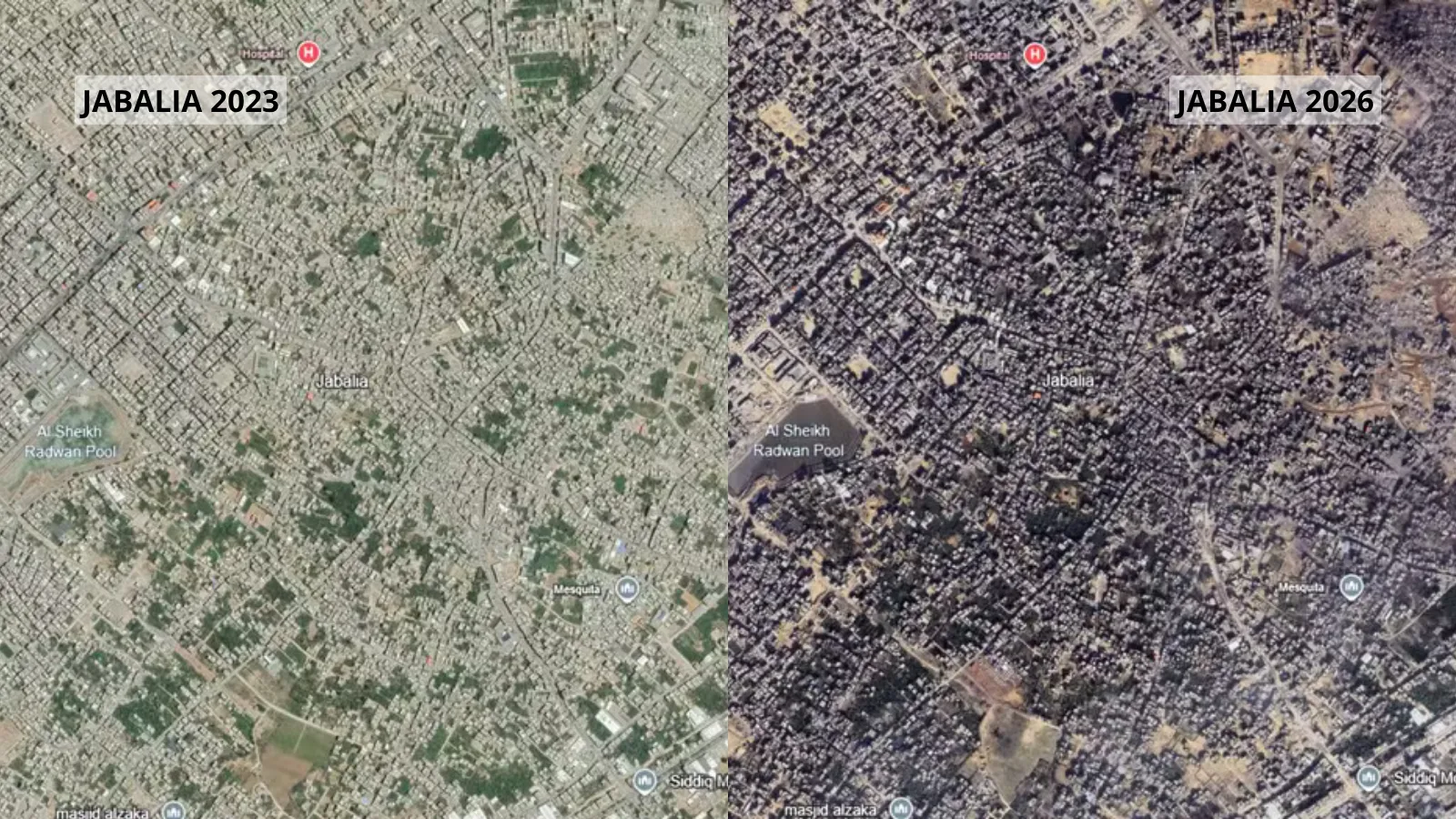
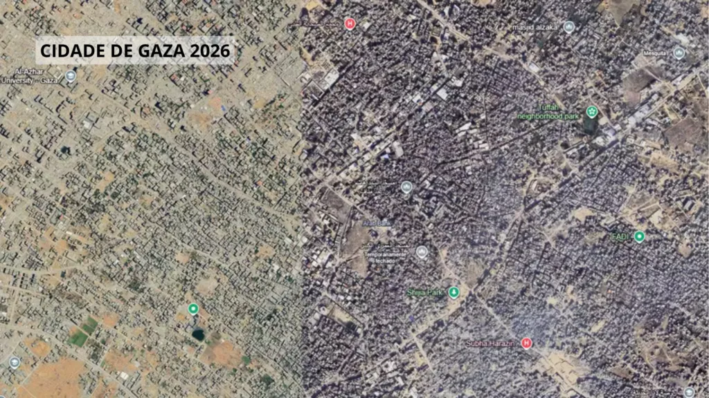
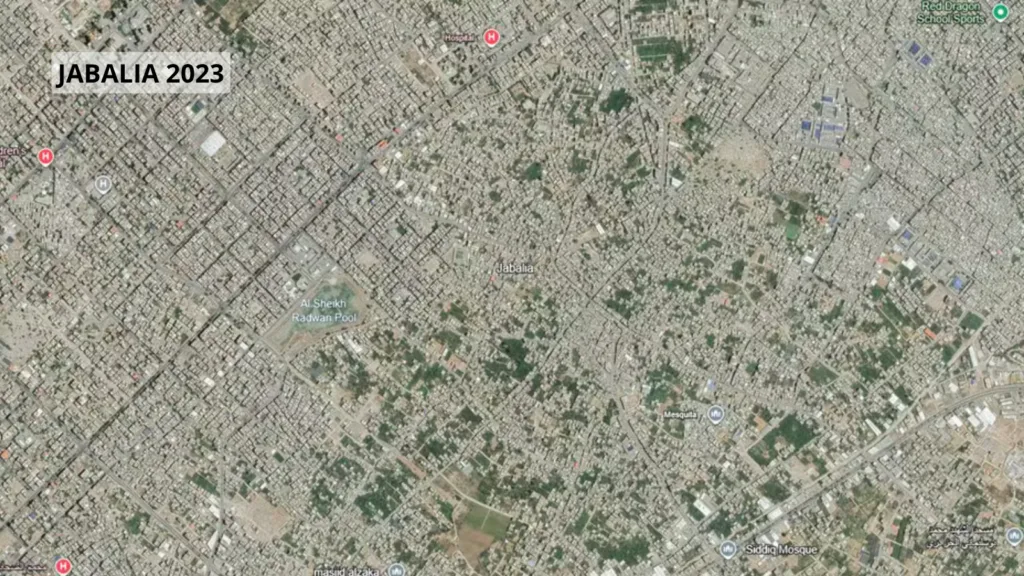
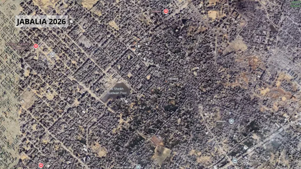
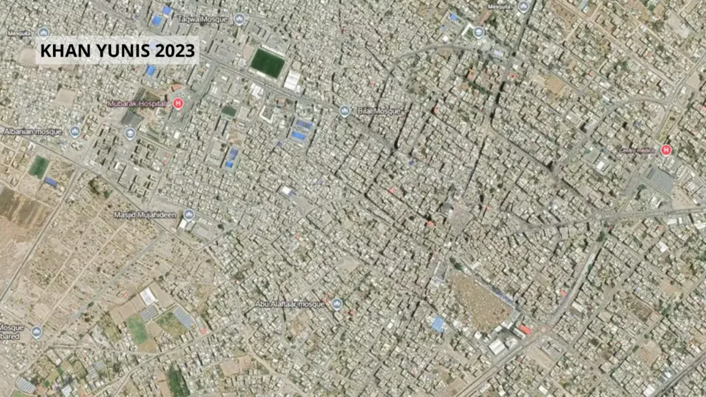
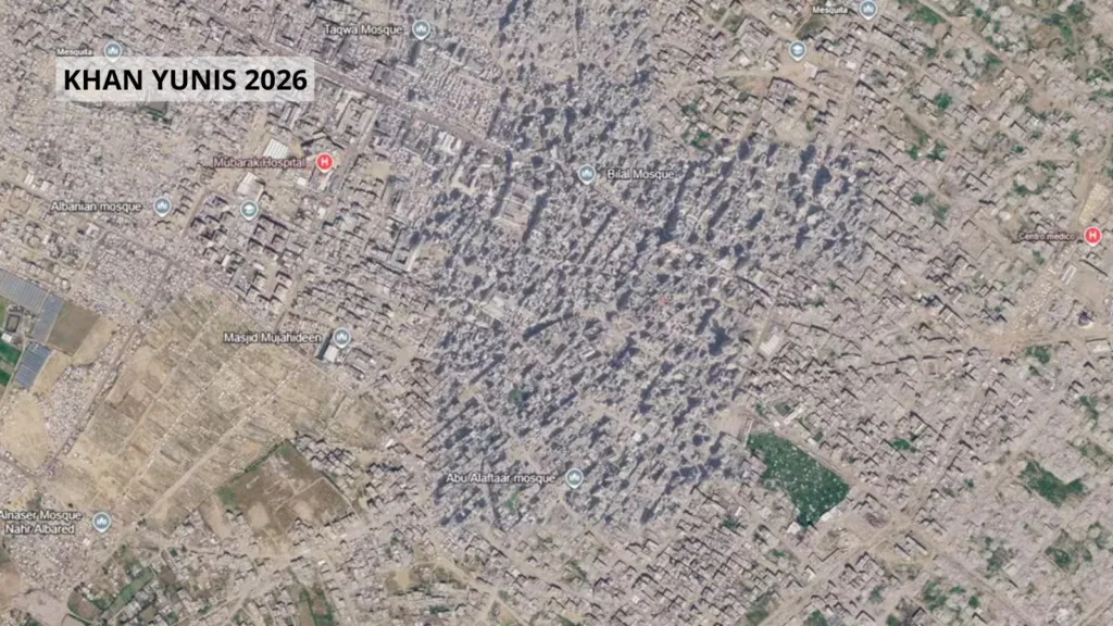
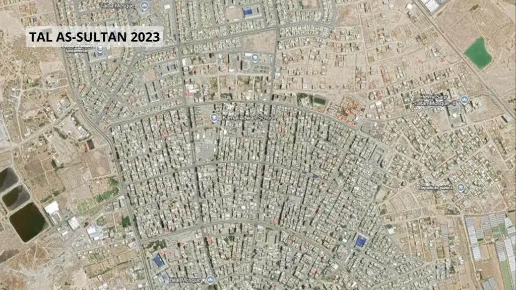
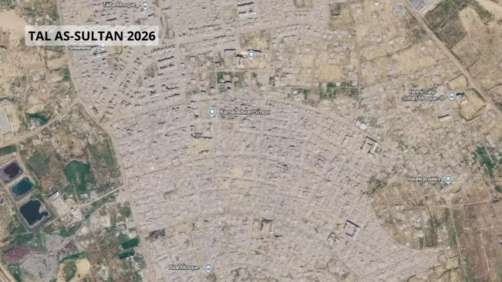
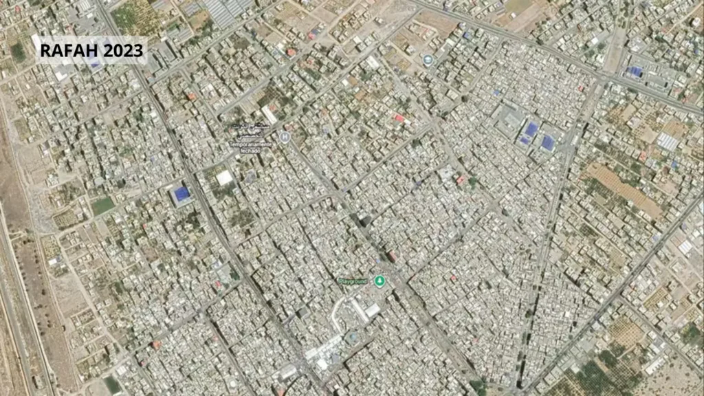
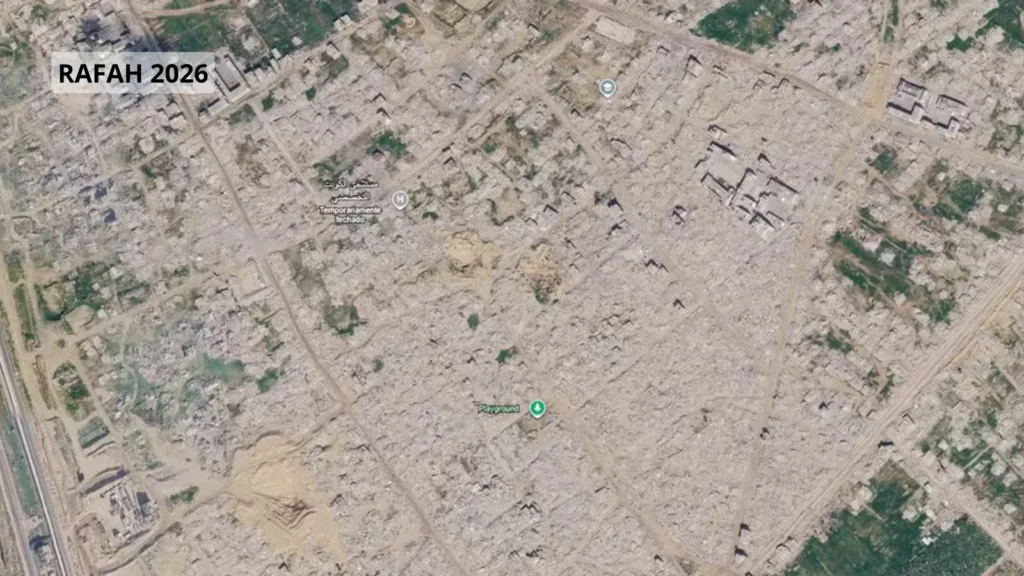
The Google Earth platform and the Google Maps service have updated satellite images of the Gaza Strip, allowing high-definition visualization of the scale of the destruction caused in the Palestinian territory. The photographs compare records prior to the October 2023 attacks with the recent physical situation of the cities, showing entire neighborhoods reduced to rubble and the presence of tent camps along the coast.
Among the areas with the highest level of devastation are Gaza City, the Al-Shifa Hospital complex, the municipalities of Rafah, Khan Younis, Jabalia, Beit Lahiya and the Tel al-Sultan neighborhood.
Places previously occupied by residences, shopping centers, water infrastructure and public buildings appear covered in debris or transformed into large expanses of packed earth.
UN data
Surveys by the United Nations Satellite Center and the United Nations Assistance Agency for Palestine Refugees (Unrwa) indicate that 82% of all structures in the Gaza Strip suffered some type of damage, with around two thirds being completely destroyed.
The total volume of rubble accumulated in the territory is estimated at 61 million tons, a value approximately 20 times greater than that accumulated in all armed conflicts in the world in the last 18 years, according to the United Nations Development Program.
Reports from Amnesty International and Human Rights Watch highlight that the destruction affected 97% of the territory’s schools, in addition to compromising the functioning of more than half of the hospitals and basic sanitation infrastructure.
The UN Independent International Commission of Inquiry, as well as Amnesty International, concluded in formal surveys that Israeli military actions in Gaza constitute the crime of genocide.
See images
Source: www.brasildefato.com.br