“The occurrence of ice and rock collapse disasters in the Himalayan region is strongly driven by climate change and responds strongly to global warming,” said Su Pengcheng, a researcher at the Institute of Mountain Disasters and Environment of the Chinese Academy of Sciences.
The scientist answered questions from Brazil in fact at the recent press conference held in Gyirong (or Jilong) County in Xigaze, Xizang Autonomous Region, regarding the disaster caused by the collapse of a glacier on the Nepalese side of the border with China.
The region also presents complex geological conditions and frequent tectonic activity. The Nepal earthquakes of 2015 and last year are examples of this, Su explained.
The researcher said that, given the acceleration in the frequency of rare catastrophes, it is “necessary to deepen basic research on risk identification and assessment, develop dynamic models for simulating disaster chains and expand monitoring coverage from the areas of origin”.
The challenge is not simple: in the Himalayan region, sharp images can be obtained in only about 20 days a year, Ge Daqing, deputy director of the China Center for Aerogeophysical Survey and Remote Sensing of Natural Resources, told the Chinese newspaper China Daily. According to him, most of the optical data recently received from the site was covered by clouds.
The researcher also highlighted that the origin of the collapse on the Nepalese side is beyond the reach of Chinese monitoring. He argues that, to face these types of risks in the future, mechanisms for cooperation and cross-border data exchange between countries in the Himalayan region are necessary.
The scale of the disaster
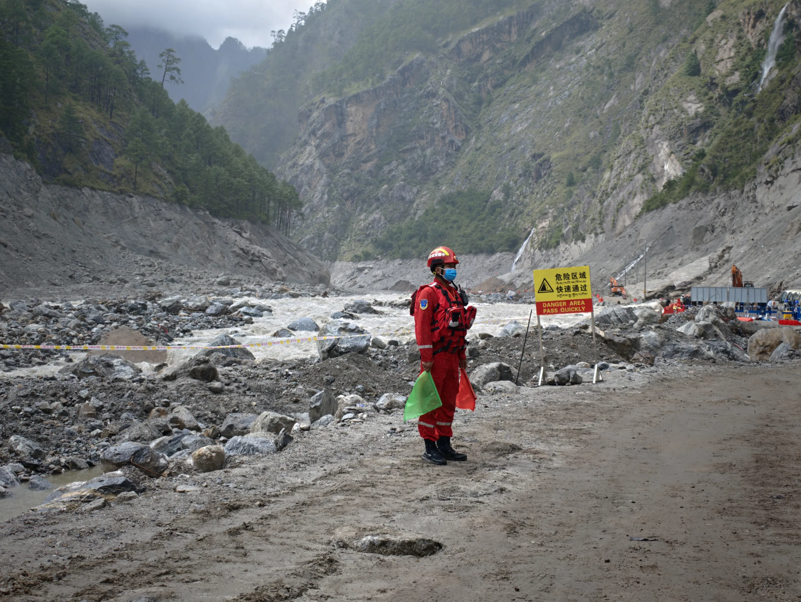
The August 26 disaster on the Sino-Nepalese border destroyed 27 buildings in the Jilong customs area, including its five-story building and the Friendship Bridge, which connected the two countries. On September 6, 11 days after the incident, the Brazil in fact was part of the first foreign press delegation authorized to access the most critical area. So far, the victims of the two countries total 1,385 dead and 5,519 missing, with 43 dead and 519 missing on the Chinese side, and 1,342 dead with more than 5 thousand missing in Nepal, including 589 foreigners.
The origin of the event was the collapse of a glacial lake measuring tens of millions of cubic meters that caused a huge slide of ice and rocks at an altitude of approximately 5,200 meters. The collapse covered 22 kilometers in less than seven minutes until reaching the land port, which is located at an altitude of approximately 1,800 meters. The flow of rocks and mud was so intense that it rose three kilometers against the current of the Donglin Zangbo River, in Chinese territory.
“The glacial sediments in the lower portion of the slope ruptured, generating a high-speed debris flow. This flow descended through the Dongling Zangbu valley and, upon encountering a barrier, the accumulated energy violently threw it against the opposite slope. A temporary dam formed there and soon broke, triggering the disaster. The fall of more than 3,000 meters in altitude released immense energy”, explained Ba Renji, senior research engineer at the Geological Survey of China, in an interview with Brazil in factat the site of the disaster.
Cleaning, search and rescue work
More than 2,300 rescuers and 8,800 pieces of equipment work in the disaster area, which was divided into seven sectors. The central area, where the border post was located, was the most devastated. The first task was to clear and reconstruct three kilometers of National Highway G216, which was the only access road to the region.
Zhou Zhidong, a geology expert from China Anneng Group, coordinated the search method in the central zone. “The technique we adopted is a refined search and clearance method, which combines heavy machinery and manual work. We remove one layer of debris at a time, with shovels and other tools, until reaching the original soil level,” he said.
Ren Wei, executive vice president of the People’s Government of the Xizang Autonomous Region, spoke about the level of difficulty of the work: “The teams overcame excessive accumulation of mud, intense rains, strong currents, unstable terrain and destroyed roads, advancing by land, water and air to the central zone”.
Ren reported that 499 residents of the affected municipalities and villages were transferred and accommodated in hotels and inns in the region at no cost. The operation also evacuated 555 tourists stranded in the area and secured the livelihood of 1,720 Nepali residents at the border.
The risks that remain
Deng Buchuan, deputy director of the Special Disaster Rescue Department of the Xizang Fire Department, said the biggest concern currently is rockfalls.
At the press conference on September 6, the Brazil in fact asked about the secondary risks still present. Su Pengcheng said that monitoring is permanent and that the visit of the delegation of foreign journalists could have been cancelled. He stated that 20 specialists were monitoring the region with more than 100 pieces of equipment. During the morning of the visit, in the area where the collapse originated, more than ten mini-ice avalanches had been recorded.
“The real elevated risk comes mainly from large individual ice and rock collapses that can block the channel. The threat can be summarized as follows: medium to high level secondary risks, predominantly localized water impoundment and small-scale temporary dams. In extreme situations, there is a real risk of blockage and rupture of a channel. This risk primarily threatens the safety of rescue teams working downstream,” said the researcher.
Source: www.brasildefato.com.br