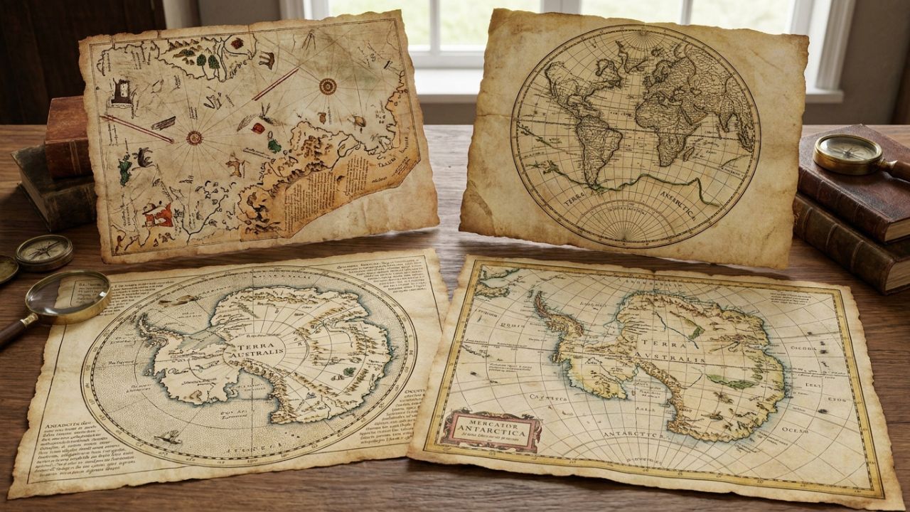
The history of cartography is often viewed as a linear progression from myth to measurement, a slow accumulation of data that eventually filled in the blank spaces of the globe. However, few subjects ignite as much passionate debate and speculative inquiry as the depiction of Antarctica on maps created centuries before its official discovery in 1820. While mainstream science maintains that the continent has been buried under millions of tons of ice for at least fifteen million years, a collection of enigmatic charts suggests otherwise. These artifacts appear to show coastlines, rivers, and mountain ranges that correspond to subglacial topography only revealed by modern seismic surveying in the twentieth century. This article explores four of the most significant ancient maps that seemingly portray an ice-free Antarctica, examining the historical context, the scientific anomalies, and the enduring mysteries they present to historians and geologists alike.
🧭 The Piri Reis Map of 1513: A Fragment of Lost Knowledge
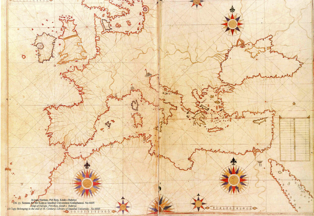
Perhaps the most famous and intensely scrutinized artifact in this genre is the fragment of a world map drawn by the Ottoman admiral and cartographer Piri Reis in 1513. Discovered in 1929 during renovations at the Topkapi Palace in Istanbul, this gazelle-skin parchment contains detailed annotations in Turkish and depicts the western coasts of Africa, the eastern coasts of South America, and a southern landmass that many researchers identify as Queen Maud Land in Antarctica. What makes this map extraordinary is not merely its age but the specific geographical details it includes. The southern coastline is shown with remarkable precision, featuring bays and peninsulas that align closely with the bedrock topography beneath the Antarctic ice sheet as mapped by Norwegian-British-Swedish expeditions in the late 1940s and later confirmed by satellite radar.
Piri Reis himself provided a clue to his methodology in the marginal notes. He explicitly stated that his map was compiled from twenty older source charts, including Portuguese maps, Spanish maps, and even a map captured from Christopher Columbus. This admission suggests that the depiction of the southern continent was not a product of sixteenth-century Ottoman exploration but rather a preservation of much older geographical knowledge. Critics argue that the southern landmass is simply the east coast of South America bent at an angle to fit the parchment, or a fanciful representation of the mythical Terra Australis Incognita. Yet proponents point out that the latitude and longitude markings, while imperfect, place the feature far too south to be South America and include specific river systems and mountain ranges that do not exist on any known sixteenth-century chart of the New World. The Piri Reis map remains a primary piece of evidence for those who believe that a maritime civilization mapped the Antarctic coast during a warmer climatic epoch before the current glaciation fully enveloped the continent.
🌍 The Oronteus Finaeus Map of 1531: Rivers Beneath the Glacier
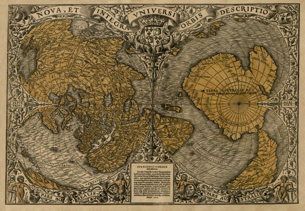
Two decades after Piri Reis, the French mathematician and cartographer Oronce Finé, known as Oronteus Finaeus, produced a cordiform world map in 1531 that offers an even more detailed vision of the southern polar region. Unlike the fragmented nature of the Piri Reis chart, the Finaeus map presents a complete and symmetrical Antarctica positioned centrally at the bottom of the projection. Most striking are the depictions of estuaries, rivers, and open waterways penetrating deep into the continental interior. Modern glaciology tells us that Antarctica is currently a frozen desert where liquid surface water is virtually nonexistent, yet seismic data has confirmed the existence of massive subglacial lakes and ancient river valleys buried beneath kilometers of ice. The Finaeus map appears to show these very features as if they were active surface hydrology.
Scholars who study this map note that the overall shape of the continent bears a stronger resemblance to the actual outline of Antarctica than almost any other pre-twentieth-century map. The Ross Sea region is identifiable, and the Wilkes Subglacial Basin seems to be represented with uncanny accuracy. Skeptics maintain that Finaeus was engaging in artistic speculation, filling in the unknown southern regions with imaginative geography to create visual balance on his cordiform projection. They argue that the rivers are merely decorative conventions common in Renaissance cartography. However, the specificity of the coastal indentations and the positioning of major geographic features challenge the notion of pure invention. If Finaeus was guessing, he guessed with a level of accuracy that would not be independently verified until the advent of ice-penetrating radar over four hundred years later. This map continues to fuel discussions about whether Renaissance cartographers had access to surviving records from a pre-glacial survey of the southern continent.
⚓ The Zeno Map of 1558: Nordic Voyages and Phantom Islands
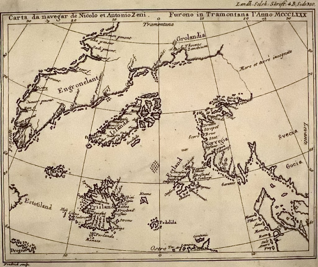
The Zeno Map occupies a unique and controversial position in the canon of anomalous Antarctic cartography. Published in Venice in 1558 by Nicolo Zeno, it purportedly reproduced a fourteenth-century chart created by his ancestors, the Zeno brothers, who claimed to have sailed across the North Atlantic and encountered lands beyond Greenland. While the map primarily focuses on the northern regions, its implications for southern cartography are profound because it demonstrates that medieval mariners may have possessed navigational knowledge far exceeding what conventional history credits them with. More directly relevant to Antarctica is the way the Zeno Map influenced subsequent southern depictions and the ongoing debate about whether certain “phantom islands” in the southern ocean were actually misidentified portions of the Antarctic Peninsula or nearby archipelagos seen during brief interglacial warm periods.
The authenticity of the Zeno Map has been fiercely contested since the eighteenth century, with many scholars dismissing it as a Renaissance hoax designed to bolster Venetian claims to New World discovery. Nevertheless, some researchers argue that even if the narrative surrounding the Zeno brothers was embellished, the underlying cartographic data may derive from genuine lost Norse or earlier sources. When considered alongside the Piri Reis and Finaeus maps, the Zeno Map contributes to a broader pattern suggesting that fragments of accurate polar geography circulated among European cartographers long before the age of official Antarctic exploration. It serves as a reminder that the transmission of geographical knowledge in the pre-modern era was complex, nonlinear, and frequently obscured by political agendas, commercial secrecy, and the simple loss of documents over centuries. The map challenges us to reconsider the capabilities of medieval navigation and the possibility that the icy barriers of the polar regions were not always as impenetrable as they are today.
🏛️ The Buache Map of 1737: A Visionary’s Controversial Legacy
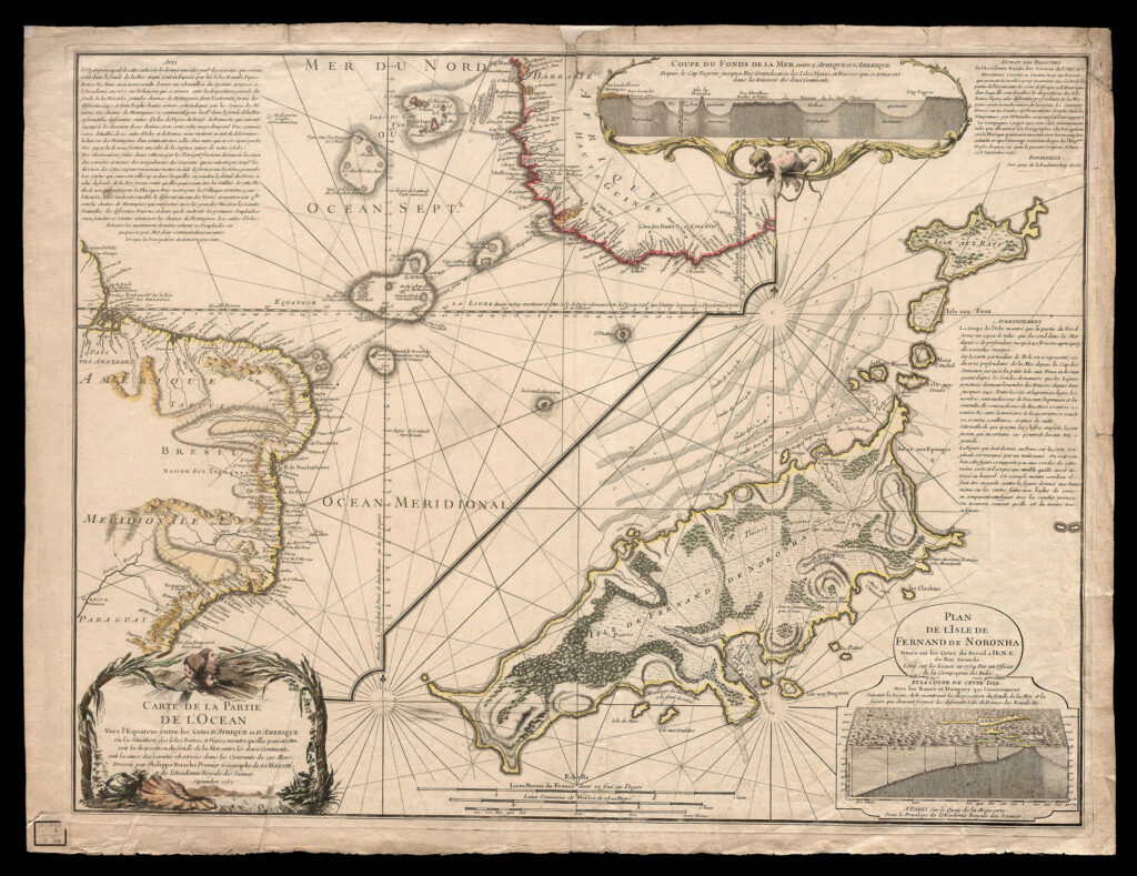
Philippe Buache, the first royal geographer of France, published a map of the southern hemisphere in 1737 that stands as one of the most intellectually ambitious and scientifically contentious representations of Antarctica ever produced. Buache did not claim to have visited the region nor did he cite ancient sources in the manner of Piri Reis. Instead, he applied theoretical principles of physical geography and hydrography to deduce what the southern continent must look like based on the configuration of surrounding oceans and the need for geological counterbalance to the northern landmasses. His resulting map shows Antarctica divided into two distinct landmasses separated by a vast inland sea connecting the Ross and Weddell Seas, a feature that eerily anticipates the modern understanding of the West Antarctic Rift System and the subglacial troughs that separate East and West Antarctica.
Buache’s contemporaries largely rejected his map as speculative fantasy, and for good reason, since no explorer had ventured far enough south to verify his claims. Yet when twentieth-century scientists finally mapped the subglacial topography using seismic reflection techniques, they discovered that Buache’s theoretical inland waterway corresponded remarkably well to actual subglacial basins and low-lying regions that would indeed form marine channels if the ice were removed and the land rebounded from glacial depression. Critics rightly point out that Buache was working from theory rather than observation, and his accuracy may be partly coincidental or the result of lucky deductions based on sound geological reasoning. Still, the Buache Map represents a fascinating intersection of Enlightenment rationalism and anomalous accuracy, raising questions about how much can be inferred about hidden landscapes through logical deduction alone and whether some of the “ancient” knowledge attributed to lost civilizations might instead reflect intuitive leaps by brilliant early modern scientists.
🔬 Scientific Perspectives and Enduring Questions
The scholarly consensus regarding these four maps remains firmly skeptical. Mainstream historians of cartography attribute the apparent accuracies to a combination of coincidence, artistic convention, retroactive fitting of modern data onto vague historical outlines, and the human tendency toward pattern recognition. They emphasize that all four maps also contain numerous glaring errors, misplaced features, and fictional elements that undermine their credibility as reliable geographical documents. Furthermore, paleoclimatological evidence strongly indicates that Antarctica has been glaciated for millions of years, making human habitation or surveying during the Holocene extremely unlikely. The last time Antarctica was truly ice-free was during the Eocene epoch, roughly thirty-four million years ago, long before anatomically modern humans existed.
Despite this skepticism, the maps continue to captivate researchers outside the mainstream and inspire interdisciplinary investigations into climate history, cartographic transmission, and the limits of archaeological knowledge. Some geologists have begun to explore whether localized deglaciation events or coastal refugia during past interglacials might have exposed portions of the Antarctic coastline within the timeframe of human civilization, potentially allowing for limited observation that could have been preserved through oral tradition or lost documents. Others focus on the historiography of cartography itself, studying how these maps functioned as cultural artifacts that reflected contemporary anxieties about the unknown and aspirations for mastery over the natural world. Whether viewed as evidence of lost civilizations, products of inspired guesswork, or simply beautiful errors, these four ancient maps remind us that our understanding of Earth’s history is always provisional and that the boundaries between myth and memory are often as shifting and treacherous as the ice sheets they purport to reveal.