Earthquake occurred at a depth of 25 km and had its epicenter on Sunday, at 9:47 am (local time)
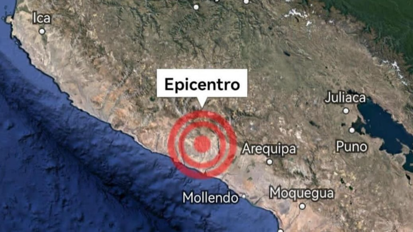
An earthquake of magnitude 6.3 was recorded on the south coast of Peru, more precisely in Caravelí, in the Arequipa region, on Sunday morning (June 16, 2024). The earthquake occurred at a depth of 25 km and had its epicenter in the Pacific Ocean, at 9:47 am local time (11:47 am Brasília time), according to information released by the Geophysical Institute of Peru.
COEN (National Emergency Operations Center) and local and regional police authorities reported that the earthquake was strong in several districts in the provinces of Arequipa, Camaná, Caravelí, Condesuyos and Islay.
In a statement, the National Institute of Civil Defense reported no casualties.
Despite the strength of the tremor, the Directorate of Hydrography and Navigation of the Peruvian Navy ruled out the possibility of a tsunami.
Peru, situated on the Pacific Belt of Fire, is no stranger to seismic activity. Preparation and immediate response are essential to minimize damage and protect the population.
Source: https://www.poder360.com.br/internacional/peru-registra-terremoto-de-magnitude-63-nao-ha-risco-de-tsunami/